Network of Permanent GNSS Station Institute of Geodesy of Lviv Polytechnic «National University»
Global Navigation Satellite System
The Global Navigation Satellite System (GNSS) is a system that allows to determine the spatial position of terrain objects by processing the received satellite signal by the GNSS receiver. GNSS consists of three segments: space, terrestrial and users.
Learn moreOur Services
GNSS-Calendar
Convert normal date to year, week or day of the GNSS calendar and download of additional GNSS products.
Geodetic calculator
Transformation of coordinates of points between different coordinate systems within the territory of Ukraine.
Upload Rinex Files
Download daily 30-second or hourly 5-second raw measurement files in Rinex format.
Instructions
Instructions for setting up and using Geoterrace Permanent GNSS Network products and services.
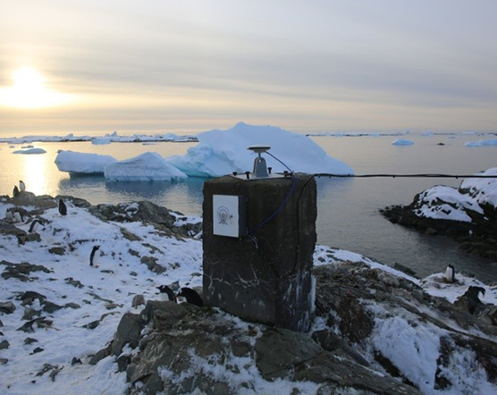
Станція ASAV, Антарктида
У рамках сезонної 24-мої Української антарктичної експедиції (січень-ківітень 2019р.) поблизу УАС «Академік Вернадський» встановлено та введено у дію перманенту ГНСС-станцію ASAV
ГНСС-антена встановлена непорушно на пілоні з умовою максимального огляду ГНСС-супутників, що можуть перебувати в різних точках небосхилу.
No front page content has been created yet.