There are more than four hundred sacral wooden monuments in the Lviv region, which need special protection. In addition to the ongoing conservation efforts, the most pressing issue is updating existing and creating new graphic materials. The basis for creating any drawings is the measurement data of the object. Today, ground-based 3D laser scanning (NLS) is considered to be an advanced method of high accuracy and maximum detail.
Due to the urgency of the problem, during 2012-2015, a large-scale project on fixing monuments of local and national architecture — scanning the wooden churches of Lviv region, was carried out in the Lviv region. The project was carried out in accordance with the Regional Program for the Preservation of Monuments of Wooden Sacral Architecture of the Lviv Region, commissioned by the LODA Department of Cultural Heritage and Cultural Property. The project was carried out by the Institute of Geodesy of NU Lviv Polytechnic.
The choice of this method of shooting is fully justified, because nowadays the NLS is the only method that allows to determine at a high speed (hundreds of thousands of points per second) the coordinates of a significant number of points on the surface of an object with an accuracy of several millimeters to 4 cm without significant surface distortions. This technology is implemented with the help of special devices — terrestrial laser scanners, which measure the horizontal and vertical directions of laser radiation propagation and oblique distances. Laser scanning data allows you to fully reproduce any object as a 3D spot model. Further construction of the model of the structure occurs by logically determining the affiliation of each point or group of points to a certain surface and creation of corresponding points on these points. Point cloud analysis is simplified by assigning a color to each point. This is achieved through the operation of an integrated or external digital camera of the laser scanner — the measurement data is combined with the image.
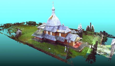
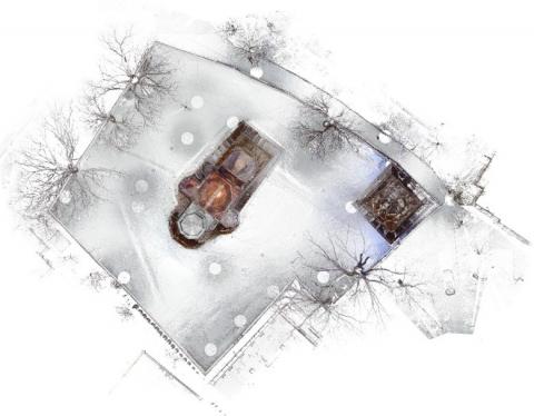
Fragment of a point model of the Church of the Transfiguration in the village of Sokal district
The resulting point model makes it possible to perform various measurements of the visible elements of the structure of the church, serves as the basis for the construction of a 3D model or a regular plan or intersection. The processing of such data requires high technical parameters of the computer, since a 3D model of a scanned object can consist of billions of points. In addition, the result of the scan depends largely on the software in which the point clouds are processed. Despite the disadvantages of working with scanning data, experience has confirmed that all the features described in the technology allow 3D scanning to be used effectively in various areas, especially in the field of cultural heritage preservation.
In order to collect digital data on the construction of Lviv monuments, 79 sacral structures were measured within the project: 55 churches, 1 church, 1 cemetery chapel, 22 bell towers. From this list, 4 sites are listed as UNESCO World Heritage Sites, 34 churches and 11 bell towers are national monuments, 15 churches and 3 bell towers are local monuments, and 4 are newly discovered architectural monuments .
In addition to the work done in the NLS of the wooden churches of Lviv region, other cultural heritage sites were scanned, including:
- Church of Sts. Mary Magdalen (Vovkov village of Pustomitivskiy district);
- Pinzel Sacred Baroque Sculpture Museum (Lviv);
- Small Maximilian Tower # 3 (Lviv);
- The wooden church of Archangel Michael (Smolnik, Poland).
|
Scheme of the church and the bell tower of St. Yuri in Drohobych |
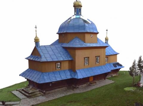
Computer model of wooden church The Virgin Mary in the village Greater Poland Yavoriv district
|
|
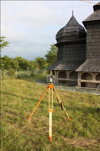
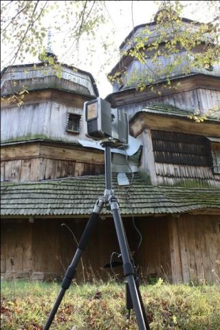
The process of scanning the church |
The process of scanning the church |