The construction of HPP and NPP is an active interference in geological-tectonic, geodynamic and hydrological conditions, which can lead to the activation of deformation processes of engineering structures and, as a consequence: to the death of people, accidents, destruction and material damage. Therefore, since the end of the twentieth century, the prediction and prevention of emergencies have become the subject of active research. Geodetic monitoring plays an important role in such studies. Geodetic monitoring of deformation processes of engineering structures of HPPs and NPPs means a set of continuous systematic studies of the movement of the earth’s surface, tectonic plates, determination of displacements of structures and technological equipment.
Representatives of the Institute of Geodesy are conducting geodetic monitoring of Ukrainian HPPs and NPPs. The main monitoring method recently is periodic static satellite measurements (seasonal cycles). It was found that the mean square errors of coordinate determination by this method did not exceed 2 mm — for points with forced centering and 3 mm — for points centered on a tripod. This method is considered a classic method of satellite measurements. The principle of which is that simultaneous measurements are made between two or more stationary GNSS receivers. The length of the observation session depends on the length of the lines being measured, the number of satellites simultaneously visible, the type of receivers and the accuracy required. This method was used by the representatives of the Institute of Geodesy to monitor a number of Ukrainian HPPs: Kaniv HPP (May, October 2007, 2010); Kremenchug HPP (2007); Dneprodzerzhinsk HPP (May, October 2007); Tereble-RitskHPP (2016, 2019); Dniprovskaya HPP-1 (2005, 2010); Dnister HPP (2003-2019).
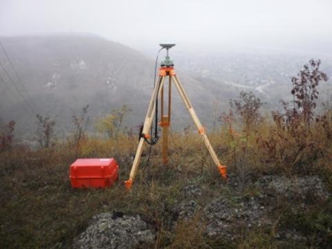
Point 221 of the monitoring net work of the Dniester HPP
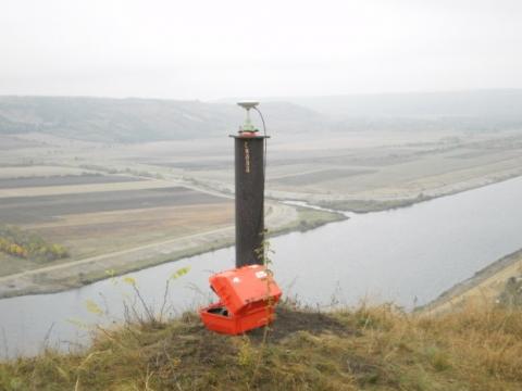
Point "Scala" of the monitoring net work of the Dniester HPP
Precise GNSS observations were performed at all HPPs, according to the observation program previously tested at the Dniester HPP. According to the results of the GNSS measurements, the spatial displacements of the monitoring net work points of the mentioned HPPs were determined.
In addition to GNSS observations, cycles of linear-angular measurements with a high-precision robotic electronic tachometer are carried out at the Dnipro HPP, the Dniester HPP and Tereble-Ritsk HPP.
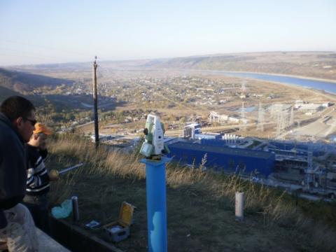
Linear-angle measurements of the Dnister HPP
In 2006 measurements were taken by the staff of the Institute of Geodesy to determine the sedimentation of hydraulic structures of theDnisterHPP-1. In addition to the observations on the territory of the station, the course of level of II class was laid to «tie» the deformation monitoring network to the state altitude network of Ukraine.